The map below shows our active working area – noting that Castlemaine Landcare Group has a wider allocated working area.
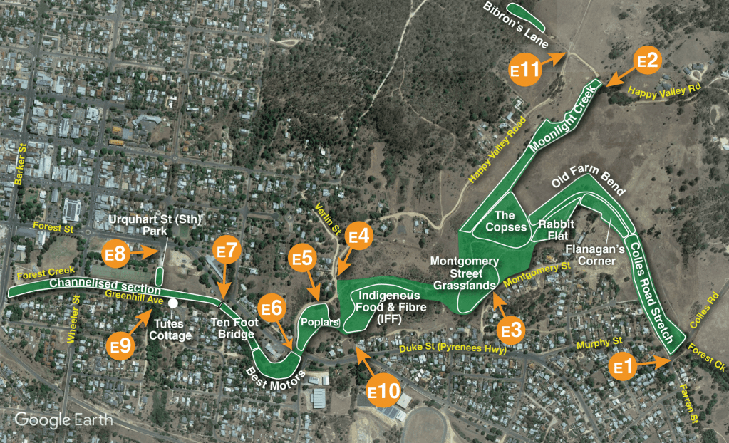
| WORK AREA | ENTRY POINT | MAP LABEL |
| Best Motors | track between Best Motors and the bridge | E6 |
| Bibrons Lane | from Happy Valley Road | E11 |
| Colles Road stretch | from Farran Street | E1 |
| Channelised Section | in Greenhill Avenue via Wheeler Street | E9 |
| Flanagan’s Corner | from Farran Street | |
| Indigenous Food & Fibre (IFF) | from Leanganook track (close to where Happy Valley Road intersects with Verlin St) or from track off Duke Street | E4 E10 |
| Montgomery Grassland | from Montgomery Street | E3 |
| Moonlight Creek | from Happy Valley Road | E2 |
| Old Farm Bend | from Happy Valley Road then follow fence line via Copse area | E2 |
| Poplars Area | from Happy Valley Road, steep track west of corner house | E5 |
| Rabbit Flat | along Leanganook Track or walk down track from Montgomery Street | E1 E3 |
| Ten Foot Bridge | from Duke Street or Green Hill Avenue | E7 |
| The Copses | from Happy Valley Road | E2 |
| Urquhart Street South Park | from Forest Street | E8 |
